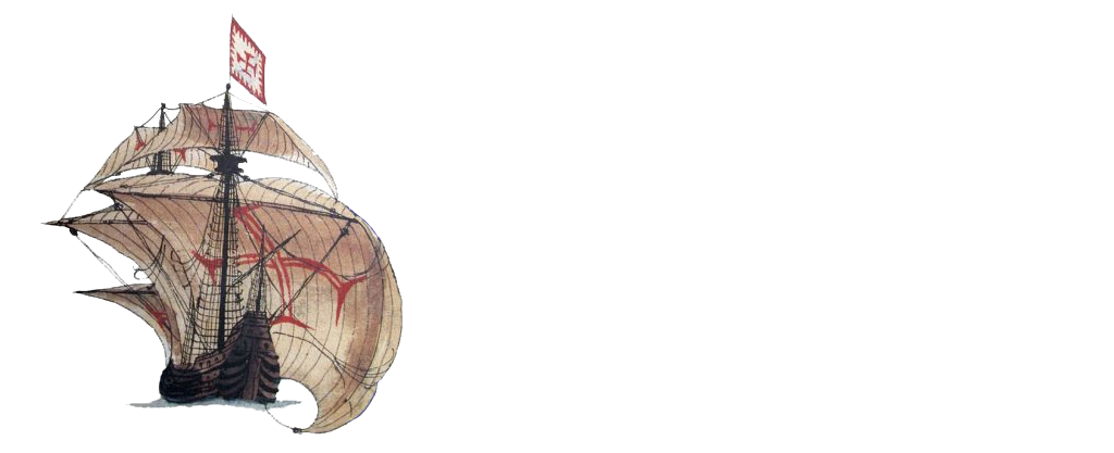
Conquistador, 1741
Jesús Alberto Aldana Mendoza
Country: Colombia
Place: Bocagrande, Cartagena de Indias
Coordinates (approximate): Lat. ; Long.
Type: Ship of the Line
Identified: Navío de Línea Conquistador
Dated: 1741
Introduction
The English siege of Cartagena de Indias between March and May in the year 1741 produced a large number of shipwrecks throughout the bay of the city, the result for both sides was catastrophic. This is because, despite the Spanish victory for control of the port, a large number of both fortifications and ships were destroyed during the battle. The English, for their part, not only suffered a great defeat despite the immensity of their fleet of almost 200 ships, but also left a considerable number of shipwrecks in the city. The sum of all these events of the war and the artifacts that were deposited in land, coastal, intertidal, and underwater contexts throughout the bay reflect an enormous archaeological potential that has been analyzed in recent years through interdisciplinary research. One study was the non-intrusive archaeological investigation carried out in 2001 of one of the possible Spanish battle ships. Initial interpretations suggest that it was the Navío de Línea Conquistador, one of the ships that, as a last resort, was intentionally sunk in the Canal de Manzanillo to prevent the passage of the English fleet to the internal bay of Cartagena de Indias and, eventually, to the city. This tactic was devised by the leaders of the Spanish defence (Blas de Lezo and Sebastián de Eslava), who, faced with the number of enemy troops and their advance guard, decided to unite, in the only channels of access to the city, the main defence fleet composed of six Ships of the Line (Conquistador, Dragón, San Felipe, África, San Carlos and Galicia). Few of them achieved their objective, however, the Conquistador was not one of them. The historical and archaeological approximations formulated around this shipwreck located in the vicinity of the Bocagrande sector suggest that this vessel is the Conquistador, nevertheless, due to the date of the study and the conditions of the time it is still necessary to formulate new approximations to corroborate if this vessel corresponds with its initial identification.
Approximate location of the ship (Google Earth)
Team
The study of the shipwreck is one of the first investigations of an archaeological nature in Colombia, with the support of a large number of professionals and students from different disciplines and institutions such as the Armada Nacional de Colombia, Centro de Investigaciones Oceanográficas e Hidrográficas (CIOH), the Departamento de Buceo y Salvamento (DEBUSA), the Universidad Nacional, the Universidad del Cauca and the Universidad Externado de Colombia.
Story of the Ship
Ship of Line of 64 canyons distributed in two decks which was built by Pedro Torres in the Real Astillero de la Habana around the year 1730, this was one of the most important shipyards for the Spanish Crown due not only to its strategic location in the Caribbean, but also to the quality of the raw materials used for the ships. Two other ships from the battle of 1741 were built in this shipyard: Dragón and África. The Conquistador, also known as “Nuestra Señora del Carmen“, was a warship that served as an escort for the colonial fleet that transported the resources of the Spanish Crown from America to Europe. Around 1737 it headed for Cartagena de Indias where it was to spend the next few years to guarantee the defense of the city, a mission that it successfully accomplished in the Spanish victory of 1741.
Representation in historical cartography of the shipwreck (Chaussereau, 1741)
Loss
In spite of the delays caused by the Spanish for the English advance party in the Canal de Bocachica, the large number of invading ships gradually entered the bay until they approached the internal sector that was defended by the Santa Cruz de Castillogrande and San Juan de Manzanillo forts and the Dragón and Conquistador ships, as well as a couple of merchant ships. The leaders of the defense decided that both ships should be drilled and sunk in the Manzanillo navigation channel, so the Conquistador was intentionally sunk in the middle of the access to avoid the English passage. However, this tactic was not successful for the defense because the Conquistador was towed by the English to the western edge of the channel, wrecking it completely and finally a couple of days later.
Find
The remains of the boat that were in the area near the Canal de Manzanillo had already been identified by the Armada Nacional de Colombia and the Dirección General Marítima (DIMAR) since a couple of decades. However, the site had not been studied from an archaeological perspective and was simply part of the shipwreck records of these institutions. Until in 2001, during the inter-institutional agreement, it was documented and analyzed in greater detail by researchers who carried out the surveys and planimetric measurements without intervening in the site through intrusive techniques.
Lifting the context of the shipwreck (Del Cairo et al., 2002)
Site Formation Process
Since the shipwreck, the ship has been exposed to a great number of cultural and anthropic factors that have produced different types of transformations in the archaeological context. In this case, the waters of the tropics continuously generate different conditions that accentuate the deterioration of the elements of the ship that have been preserved on the seabed. With regard to the site of the possible Conquistador vessel, a large number of factors have continuously affected it in recent years. In the case of the anthropogenic ones, there is the transit of vessels in the areas near the site, the interventions on the seabed and the extraction of materials (both when the vessel was recently shipwrecked, due to its shallow depth, and in recent years). With respect to the natural ones, there is the site’s fauna, the area’s microorganisms, oceanographic currents, tides and water temperature influenced by the action of the sun and the depth of the site (between 15 and 21 meters).
Ballast
During the non-intrusive work carried out in 2001, a large quantity and wide distribution of stones belonging to the ship’s ballast were found on the seabed of the site. These elements were attached to another set of ship’s artefacts related mainly to the weaponry and a number of timbers that may be linked to the ship’s hull. Likewise, some accumulations of bricks were documented which initially, due to their distribution and arrangement, were identified as the ship’s ballast.
Ship Fittings
As far as the equipment of the ship is concerned, the evidence that has been recorded was very few (only a couple of metal structures that were not identified), which is mainly due to the already mentioned historical extraction of elements not only in the last centuries but also in the weeks after the dispute with the withdrawal of the English. It is likely that due to the location where the ship was shipwrecked, the Spanish recovered several elements that were still useful for the ship, so that at present it is difficult to find the amount of elements that would be expected to be found in this type of ship.
Anchors
In the areas close to the shipwreck context, an anchor that could belong to the Conquistador had been identified for several years. This element was not reported in the 2001 survey because it had been re-deposited in another area (towards Isla de Manzanillo) to guarantee its conservation and avoid its accelerated deterioration due to the change in the environment in which it was found.
Possible anchor of the ship (Del Cairo, 2001)
Guns
Around the site, the team documented more than 10 canyons (each approximately three meters long) which were arranged in small groups and, in some cases, one on top of the other. Further information on the weaponry of the vessel could not be obtained during the study, so future interventions are intended to obtain more information on these elements and the other artifacts that are still deposited in the area.
Hull Remains
With regard to the hull of the boat, several wooden elements were documented and recorded during the planimetric surveys, however, their distribution in the site was very dispersed and it was very difficult to carry out a characterization of these for their eventual identification. On the other hand, several coral outcrops with completely straight shapes were identified on the seabed. However, since this was a non-intrusive survey, it was not possible to go deeper into these elements and it is not known to which part or object they may belong.
Personal Items
As with the other parts of the boat, elements related to life on board were not found in large quantities. It was only possible to identify a pair of amphorae and several distributions of ceramic fragments of different sizes. It is very likely that several elements of the ship are deposited under the first layers of the seabed, hence the absence of information linked to the shipwreck and, in this case, of the personal items.
Reconstruction
Due to the limited information obtained at the site, an approximation of the reconstruction of the main characteristics of the vessel has not been possible to date. However, the artifactual distribution indicates that the materials are arranged together with dimensions ranging from 50 meters long to 25 meters wide, which can give us an approximate idea of the length and beam of the ship (considering the processes of affectation that have produced the movement and transport of various elements). Based on the information indicated in the 1720 shipbuilding treaty by Antonio de Gaztañeta e Iturribalzaga “Proportions of the most essential measurements for the manufacture of ships and frigates”, it is known that a 60-gun ship of the line such as the Conquistador measures
Beam: Estimated 11.97 m. (21 codos)
Keel Length: Estimated 35.91 m. (63 codos)
Length Overall: Estimated 43.32 m. (76 codos)
Number of Masts: Three plus bowsprit.
Deliverables
Videos
https://www.youtube.com/watch?v=yUUkGhs4tak
References
Aldana, J. (2019). Propuesta metodológica para la construcción de una matriz de indicadores arqueológicos e históricos para la identificación de naufragios: El caso de un navío colonial ubicado en el canal de Bocachica (Cartagena de Indias). Universidad Externado de Colombia.
Del Cairo, C. (2013). Entre naves y fuertes: Arqueología de las batallas costeras de 1697 y 1741 en Bocachica. Isla de Tierrabomba, Cartagena de Indias. Instituto Colombiano de Antropología e Historia (ICANH).
Del Cairo, C. & Palacio, L. (2014). Prospección arqueológica y Plan de Manejo Arqueológico para la modificación de la licencia ambiental para el dragado de profundización del canal de acceso a la Bahía de Cartagena de Indias, Colombia. Aqua & Terra Consultores Asociados – Instituto Nacional de Vías (INVIAS).
Del Cairo, C., García, M., Peña, O., Pérez, J., Montaguth, K., Fuquen, C., Páez, A. & Villada, D. (2002). Arqueología de un naufragio. Memorias del curso del patrimonio cultural sumergido. Ministerio de Cultura de Colombia & Escuela Almirante Padilla.
Del Cairo, C., Palacio, L., Manrique, M., Peñarete, A., Chávez, A., Estupiñán., E. & Riera, C. (2016). Prospección arqueológica y formulación del Plan de Manejo Arqueológico para Landing Place Marina, Castillo Grande Cartagena de Indias. Bathymetrics S.A.S – Instituto Colombiano de Antropología e Historia (ICANH).
Del Cairo, C., Riera, C., Aldana, J., Báez, V., Caro, G., Chávez, A. & Peñarete, A. (2019). Patrones de Navegabilidad, Accidentalidad y Hundimientos en el Caribe Colombiano: Siglos XVI-XX Como insumo para el registro nacional de patrimonio arqueológico sumergido. Fase piloto 1. Cartagena de Indias e inmediaciones y Riohacha. Universidad Externado de Colombia – Instituto Colombiano de Antropología e Historia.
Romero, L. & Pérez, J. (2005). Naufragios y puertos marítimos en el Caribe colombiano. Siglo XXI editores.